6 weeks before
the bearing fails.
Watsynq fuses acoustic spectra, lube-oil particle counts and thermal drift into one Remaining Useful Life score — so your maintenance planner acts on evidence, not instinct.
Vibration analysis alone catches 60% of bearing defects. Too late, too narrow.
Route-based vibration rounds have been the reliability standard for decades. They work. They also miss early-stage defects that acoustic emission catches weeks before vibration signatures appear.
Acoustic emission needs MHz-range sensors
Standard vibration probes operate at 1-20kHz. Acoustic emission bearing signatures appear at 100-300kHz — a different physics domain entirely.
Single-stream data hides correlated failure modes
Inner race defects manifest differently in acoustic, thermal and oil data. Any one stream produces misleading confidence. All three together produce a reliable RUL estimate.
Route-based rounds mean 3-4 week reading gaps
Manual vibration routes run on 2-4 week cycles. Continuous monitoring closes that window — catching the transition from healthy to early-stage defect in real time.
Not one sensor. Three physics domains.
Each stream tells a different part of the bearing degradation story. Fusion weights them by equipment class and failure stage.
Acoustic Emission
We listen at 150kHz. Bearing cage defects are audible 6-8 weeks before they show up in vibration. The MHz-range stress waves propagate through the bearing housing at the moment of micro-crack propagation — not when the damage is already structural.
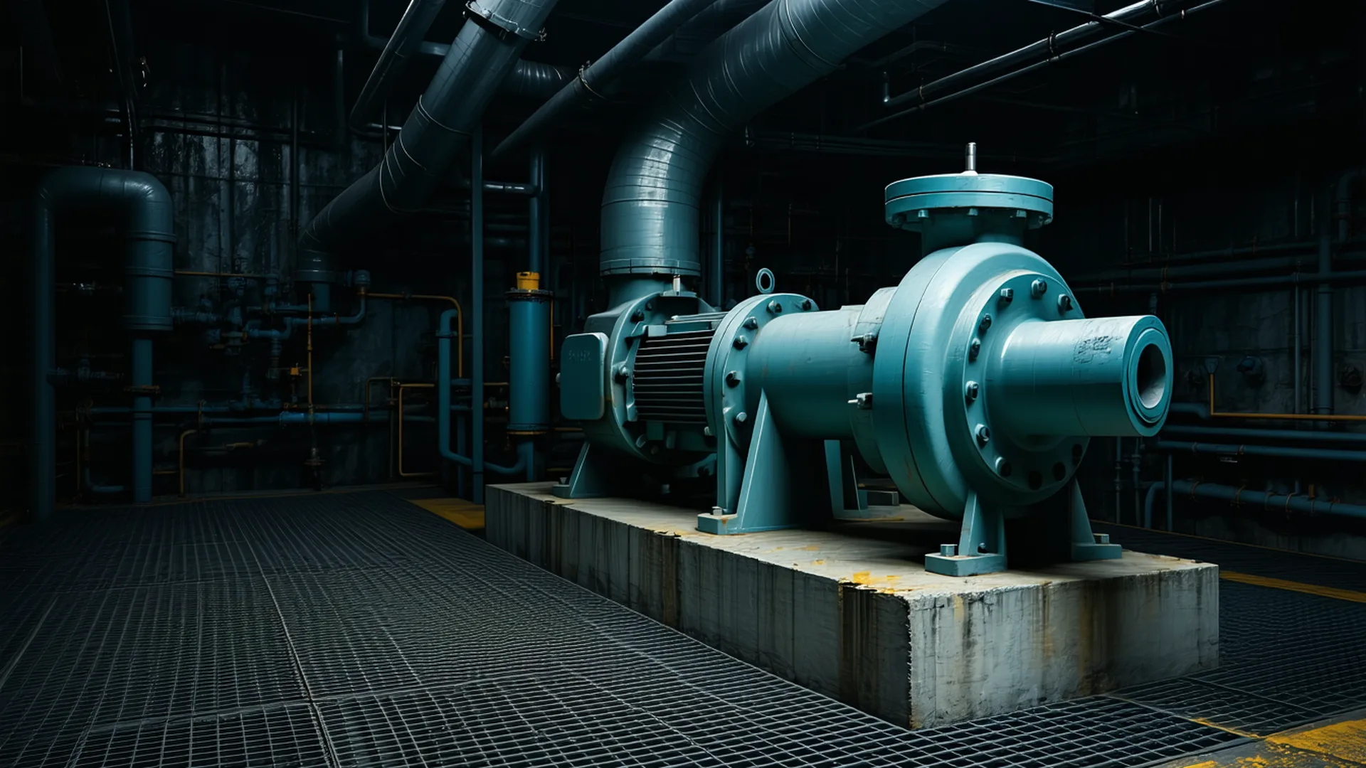
Our clip-on AE sensor clamps to the bearing housing exterior. No process stop. No bore-in fitting. Install time: under 90 minutes per point.
Lube-Oil Particle Count
ISO code trending, not snapshot. An inline particle counter measures ferrous and non-ferrous particles continuously. Rising particle generation rate precedes bearing spall formation by weeks.
Thermal Drift
Asymmetric housing temperature rate-of-change, not absolute temp. A bearing that runs at 65°C steadily is fine. The same bearing trending at +0.8°C/hour while load is constant is not.
One number your maintenance planner can act on.
The RUL score is the only number that matters in the maintenance planner's morning standup. Not three separate sensor readings. Not a fault code. A remaining-days estimate with a confidence interval.
Kiln Fan #3 — Inboard Bearing · Inner Race
95% CI: 29–49 days | Last updated: 07:14 today
30-day RUL trend
Three steps from sensor to scheduled maintenance.
No process interruption. No data science team required. RUL output delivered to the tools you already use.
01 — Install
Clip-on sensors, no process stop
Acoustic emission clamps on the housing. Oil particle counter inline-taps the existing lube circuit. Surface thermal sensor adheres with thermal paste. Typical install per monitoring point: under 4 hours.
02 — Fuse
Cloud pipeline aligns and weights signals
Timestamp normalisation, signal alignment, and failure-mode classification run in the Watsynq cloud. Physics-informed weighting adjusts per equipment class and current degradation stage.
03 — Act
RUL score delivered to your CMMS, 24/7
RUL score and confidence band pushed to Maximo, SAP PM, or any REST endpoint. Email alerts at configurable thresholds. No daily log-in required — your maintenance planner sees it in their existing workflow.
What reliability engineers say.
Two cases where acoustic emission or lube-oil trending caught the defect before the vibration route would have — and the repair went into a planned outage window instead of an emergency.
We caught a kiln fan bearing two months before our vibration routes would have flagged it. Rescheduled into a planned outage window instead of a weekend scramble.
The lube-oil trending caught a contamination issue our in-line vibration sensor missed entirely. RUL score dropped 30 days before we would have known.
Book a 30-minute walkthrough with our team.
We will show you a real RUL output from equipment similar to yours — no slides, no vendor pitch deck.