The pipe attributes that most asset management frameworks prioritize — installation year, material, diameter, break history — explain a meaningful portion of failure variance across a distribution network. But in arid climates with expansive soils, there is a variable that AWWA M36-style models consistently underweight: the dynamic load imposed by the surrounding soil as it responds to moisture fluctuations. In the Sonoran Desert, that load varies by an order of magnitude between a dry June and a saturated post-monsoon August. Ignoring it means your risk model is missing the most operationally relevant driver of near-term failures.
Expansive soil mechanics in the distribution context
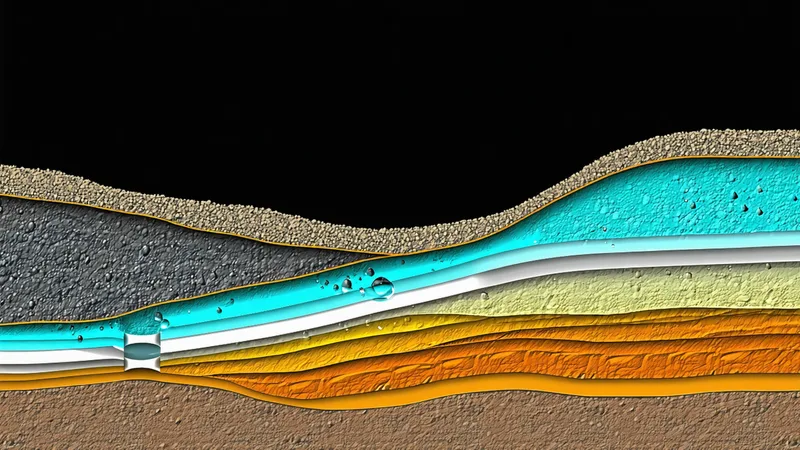
Expansive soils are defined by their swell potential — the volume change that occurs as soil moisture content changes. In Maricopa and Pima counties, the predominant fine-grained soils above the caliche hardpan layer have moderate to high swell potential, with plasticity indices commonly ranging from 15 to 35. The shrinkage-to-saturation volumetric strain for these soils can reach 3–8% under the full seasonal moisture swing typical of a Southwest monsoon climate.
Translated into physical loads on a buried pipe: the soil surrounding a distribution main exerts a lateral confining pressure that changes with moisture content. During dry periods, soil contraction reduces confining pressure and can create voids adjacent to the pipe — particularly at the 3 o'clock and 9 o'clock positions, where passive resistance is lowest. During wetting events, the soil swells back and in some cases exerts positive lateral pressures that can deflect flexible connections or displace pipe joints that have already relaxed under the previous dry cycle.
The critical insight is that this is a cyclic fatigue mechanism. A single monsoon season does not break a pipe. Twenty or thirty cycles — each one slightly displacing a joint, slightly reducing the sealing engagement of a lead or rubber gasket, slightly progressing a circumferential stress crack — accumulate into a structural condition that is genuinely compromised, even though the pipe has never experienced a single dramatic loading event.
Why strain gauges alone cannot capture the relevant signal
Inline pipe strain gauges measure hoop stress and bending stress at the gauge location, which is useful for detecting discrete high-load events. What they cannot capture is the cumulative soil-structure interaction history — how the confining conditions around a 500-meter stretch of pipe have evolved over years of moisture cycling.
Consider a scenario representative of what we see in central Maricopa County: a 10-inch AC pipe installed in 1968 running through a residential corridor that was agricultural land before subdivision development. The native soil has significant montmorillonite content and has been repeatedly wetted and dried for decades. A single strain gauge on that pipe might show normal operating stress under current conditions. But a 40-meter section crossing an irrigation easement has experienced episodic over-irrigation from adjacent landscaping — wetting events that the rest of the corridor didn't receive — and three of the rubber compression gaskets in that section have deformed and partially lost their sealing engagement as a result of additional moisture-driven joint cycling. The strain gauge tells you the pipe is not currently overstressed. It tells you nothing about the gasket condition.
Fusing soil moisture telemetry with network models
The practical challenge for a water utility is that you cannot instrument every soil cross-section along hundreds of miles of distribution main. The approach that produces actionable results combines sparse physical measurement with spatial interpolation using existing authoritative data sources.
The USDA Natural Resources Conservation Service (NRCS) maintains the SSURGO (Soil Survey Geographic Database) with mapped expansive soil indicators at the county and sub-county level. SSURGO contains swell potential and shrink-swell group classifications that can be spatially joined to pipe segment geometry in any GIS platform. This provides a static soil risk layer — which segments run through high-swell-potential soils — without any new instrumentation.
The dynamic layer is more interesting. USDA/NRCS publishes SNOTEL soil moisture sensor data for agricultural monitoring stations distributed across the region. NOAA's drought monitor and the Arizona Department of Water Resources publish county-level drought severity indices updated weekly. Coupling these publicly available moisture proxy signals with the static soil classification layer gives you a model of seasonal soil state that can modulate pipe risk scores dynamically — increasing risk scores for high-swell segments during rapid wetting events, capturing the post-drought onset as an elevated-risk window.
The additional instrumentation case — deploying point-of-interest soil moisture sensors at selected high-risk cross-sections — is justified for segments above a threshold composite risk score. A capacitance-based or TDR soil moisture sensor costs $200–600 per installation point and can provide continuous volumetric water content data at pipe depth. For segments already identified as candidates for near-term replacement, this data can help prioritize between them and flag the specific moisture state that represents peak risk.
How the soil signal enters the risk score
The soil moisture variable enters the Watsynq risk model in two ways: as a static feature (soil swell group classification for each pipe segment's geographic location, derived from SSURGO) and as a time-varying modifier (a seasonal moisture index derived from publicly available drought and soil moisture data, applied as a multiplier that increases the base risk score during high-risk soil state periods).
The model validation approach for this feature requires historical break event data timestamped against historical soil moisture records. When we look at break events in our training datasets from Maricopa County utilities, the temporal clustering around monsoon onset and the geographic clustering in high-swell-potential soil areas is statistically distinguishable. The soil features add meaningful predictive signal beyond what pipe age and break history alone explain — particularly for segments in the middle of the risk distribution, where the soil state variable is the differentiating factor between a segment that fails this season and one that holds for several more years.
We'd caution against treating the soil moisture signal as a dominant variable in isolation. Utilities sometimes ask whether they should simply use soil classification as the primary prioritization criterion. Our analysis consistently shows it's the interaction between soil state and pipe condition indicators — age, material, break history, pressure transient behavior — that produces the highest predictive accuracy. A new ductile iron main running through high-swell soil is at much lower risk than a 1962 unlined cast iron main in the same soil. A model that doesn't account for both factors simultaneously will misrank them.
What this means for DMA-level capital planning
If your distribution network includes district metered areas (DMAs) or pressure zones in high-swell soil areas, and your capital replacement queue was built primarily on age-based deterioration curves without a soil variable, it's likely that the break pattern you're experiencing is partially explained by soil interaction — and that the queue doesn't adequately weight the highest-risk soil-condition combinations.
The diagnostic check is straightforward: map your last five years of break events against SSURGO shrink-swell groups. If you see disproportionate clustering in specific soil units — particularly if those units don't align with your oldest pipe concentrations — the soil variable is doing explanatory work that your current model isn't capturing. That gap is closable without new instrumentation, using publicly available data sources.
The monsoon season is not just a weather event for distribution operations. It's a loading cycle that has been stressing your aging mains for decades. Utilities that build that dynamic into their risk models will have better answers about which segment to prioritize next quarter.
Nadia Vasquez is Head of Data Science at Watsynq.